High-Resolution Bathymetry by Learning-Based Image Superresolution
This research aims to accelerate the creation of detailed bathymetric charts. In this research, treating bathymetric charts as digital images whose pixel values represent ocean depths, we proposed to use superresolution, a technique to enhance image resolution, to estimate fine bathymetric information from coarse observation data. This approach enables us to make full use of existing data and minimize new observation, thereby realizing efficient mapping of seafloor details.
Overview
Bathymetric charts, which represent the depths of oceans, are important for various oceanic applications such as ship navigation, environmental assessment, and resource exploration. Hence, seafloor mapping to create bathymetric charts of the world oceans has been continued for a long time. While fine bathymetric charts that explain the seafloor in details are highly desired, we currently have only coarse depth data in most sea areas on the earth.
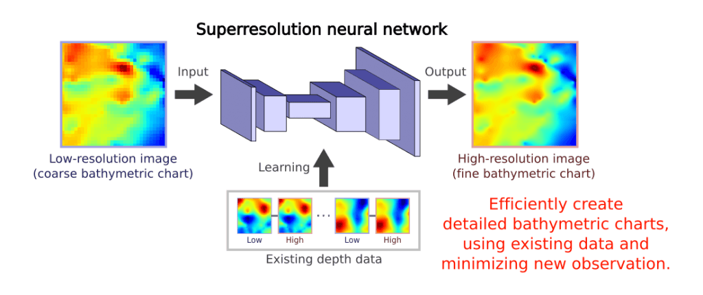
This research aims to accelerate the creation of detailed bathymetric charts. Conventional seafloor mapping requires ships equipped with special hardware to observe depths at many locations in each area, thus taking a lot of time and cost. In this research, treating bathymetric charts as digital images whose pixel values represent ocean depths, we proposed to use superresolution, a technique to enhance image resolution, to estimate fine bathymetric information from coarse observation data. This approach enables us to make full use of existing data and minimize new observation, thereby realizing efficient mapping of seafloor details.
Specifically, we employed the learning-based methodology of superresolution, which can automatically extract characteristic features of bathymetric images. First, we prepared pairs of low-resolution and high-resolution images in the same sea areas. Then, we let a neural network learn the relationship between them and estimate a high-resolution image from each low-resolution image. Finally, we performed experiments to compare the proposed method with naive bicubic interpolation. As a result, the proposed method produced results of higher quality than the standard interpolation approach in terms of both quantitative error and qualitative appearance, thereby confirming that learning-based image superresolution can recover detailed seafloor structures from coarse observation only.
Furthermore, by quantifying the uncertainty in estimation, we can find sea areas where superresolution based on current data has limited performance and thus new observation may be particularly beneficial. By using superresolution as much as possible and performing new observation only when necessary, we can greatly accelerate detailed seafloor mapping of the oceans.
